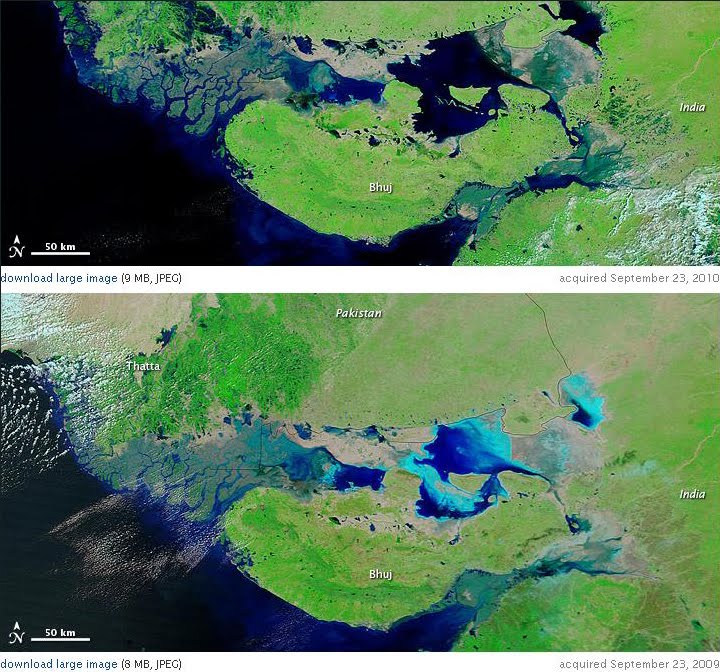
 Images (r) from Moderate Resolution Imaging Spectroradiometer (MODIS) on NASA’s Terra satellite show coastline along Pak/India border.
Top image is from September 23, 2010, and the bottom is from September 23, 2009. #
Water levels rise and fall with the seasons, but after weeks of devastating monsoon rains that displaced millions of Pakistanis, water levels in the typically shallow lakes stayed high in late summer 2010.
Opportunity to re balance floods & drought, during this shift?
 I say yes.. It's possible to engineer ecological systems to help regulate, conserve, & replenish; thus provide alt conditions to a region plagued w/ alt floods & drought.
Image: My street, from boat to access!
Fortress of water helps regulate flooding; as controls harsh severity of floods/drought.
With applied technology, and conservation, India's over-staying Monsoon; might bring a welcome rest to tapped ground wells...
Here's a video from A-Team in India (2007) [view]
Annenberg says: "Fast-paced development projects that are turning Indian cities into modern metropolises are causing traditional wells to dry up"
No... This is within the superb Indian engineers' grasp; and central to the Longevity of their Nation... Lest we hark the old saying, "You can put a Man on the Moon, but"... Solve this, and so too will Katrina & the U.S. Gulf...


